


Posted on 05 May 2023
Lights, camera, action! Peek at what lies beneath Tōtaranui | Queen Charlotte Sound
- News
- 3 Minutes to read
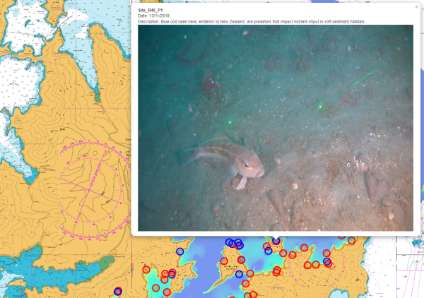
Horse mussels bedding into the sand, sponges soaking in their surroundings, and worms tubing through the seabed – this underwater world has something for everyone.
A new interactive map from the research team looking at ecological responses to cumulative effects gives a sneak peek at life and loss on the seafloor of Tōtaranui | Queen Charlotte Sound.
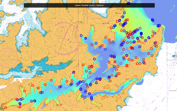
The map is built on seafloor surveys from both phases of the Sustainable Seas Challenge and shows more than 150 study sites that researchers from the University of Auckland, the University of Waikato, NIWA, and the University of Canterbury have worked at. Clicking on a point on the map reveals a photograph or video of the sea floor with a short explanation of what you can see.
Sustainable Seas Project Leader Simon Thrush says it’s important for people to see for themselves what’s happening under the sea, so they can understand all the different parts of the ecosystem, how the system works together, and how different stressors interact. He hopes better visibility will lead to better questions.
“For many people, the marine environment is ‘out-of-sight and out-of-mind'. If people were commuting through the Sounds to go home, they're going to see lots of activity on land. They're also going to see the mussel farmers operating, but they might miss half of the problems that interact with the ones they do see.”
He says the map aims to open the door for people to start thinking about what’s on the seafloor, what lives there, and how different actions and reactions affect other things in the ecosystem.
“It can help open those kinds of conversations. We weren't trying to give answers as much as get people to ask questions.”
The map is useful for educators, iwi, council decision-makers, fisheries managers, and boaties, says Simon. “Depending on their interests, people can find what they need.”
Undersea vignettes reflect what researchers saw
Images and footage for the map were gathered from projects investigating the effects of stressors on reef and seafloor ecosystems. The information gathered will help improve decision making about the risks of activities and opportunities to improve the ecological health and mauri of our coasts and estuaries.
“We love our coasts, but different people value different things, and this makes it hard to understand and support collective actions for improvement. Creating a good space for more widely engaged discussions across different interests is why the Challenge has focused on ecosystem-based management.
Simon would like anyone visiting the map to come away motivated to learn more.
“Explore the world you live in. For a New Zealander, most of it is the ocean. Think about it. Think about it every day.”
Dive into the map, hosted by the e-learning site at the University of Auckland. Explore the reefs and seafloor to spot camouflaging carpet sharks, urchins blanketed by sediment, and other ‘hidden’ sights of the Sound.

